Goes along
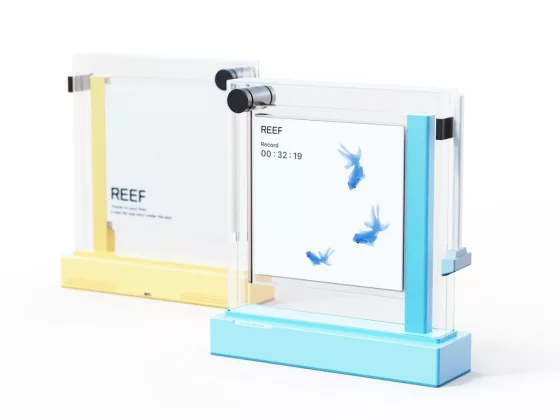
Reef: A Digital Aquarium That Turns Screen-Free Time into a Gentle Ritual
The “Reef” concept by designer Sumin Kim reimagines digital detox as a calming experience, not a res…
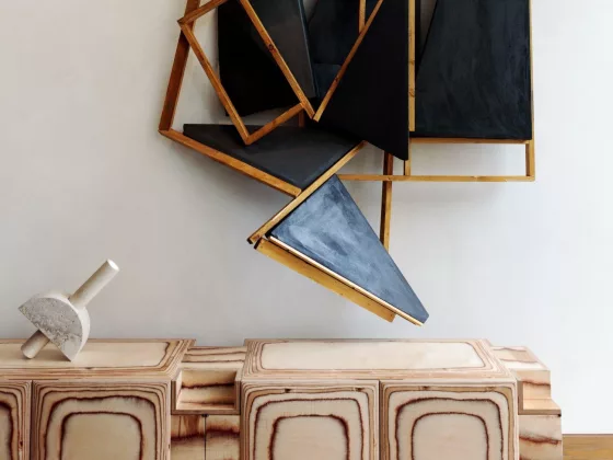
Pacific Credenza – Sculptural Surf-Inspired Storage
Meet the Pacific Credenza by Kelly Wearstler—a vision where storage becomes art, a celebration of Ca…
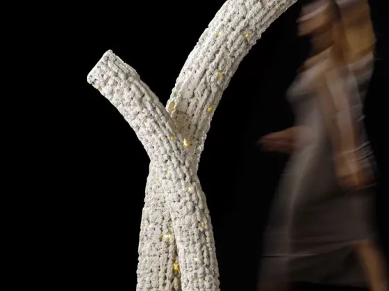
Corallite by Sanjay Puri Architects – Coral-Inspired Illumination & Sculptural Living
Introducing Corallite, a poetic fusion of design, sustainability, and oceanic inspiration. Conceived…
You might also like

Great Escapes Mediterranean: The Hotel Book
Experience the charm and beauty of the Mediterranean with Great Escapes Mediterranean: The Hotel Boo…
Living in Mexico. 40th Ed.
Experience the vibrant culture and stunning architecture of Mexico with Living in Mexico. 40th Ed.. …
Miquel Barceló Oceanographer: Dive into Coastal Living
Step into a world where the ocean meets art with the Miquel Barceló Oceanographer mural, born from t…
Coastal Living Accents & Accessories Coastal Fashion Nautical Timepieces Art & Design Art Accessories
Patek Philippe Nautilus 50th Anniversary Desk Clock
Gérald Genta sketched the Nautilus in five minutes on a restaurant napkin in 1976. Fifty years later…
Surfing. 1778–Today
Dive into the rich history of surfing with Surfing. 1778–Today, an expansive chronicle of the sport …
LeRoy Grannis. Surf Photography of the 1960s and 1970s
Celebrate the golden era of surfing with LeRoy Grannis. Surf Photography of the 1960s and 1970s. Thi…